

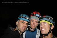
Matt and I are always about finding new places to adventure. We also thoroughly enjoy sharing our findings with those in the climbing community. Below are some pages that I have recently put up about new areas under development in Yunnan Province, China.
If you are interested in any information regarding these locations or any of the new crags under development in Yunnan, you can email me (j.ryder.stroud@gmail.com) or Dane Schellenberg (dane.schellenberg@gmail.com), one of the area's big route developers.
These pages are from my own postings over on the website Summitpost (www.summitpost.org), which is a great website for finding information on mountains, ranges, and climbing areas all over the world.
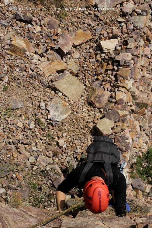
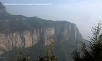
Wanxian (万仙)Mountains
Location: Guoliang and Nanping Village, Wanxian Mountain Park, Henan Province, China
Approximate Elevation: 9455 ft./2882m
Activities: Trad climbing, Sport climbing, Hiking
Overview
Disclaimer/Preface
This page is far from encyclopedic. Though I will be updating it with some topos based on photographs that I took there, I was not able to thoroughly document all of the crags during my short stay in the area. I am hoping to return in the near future, but I had to supplement my knowledge of some crags with information from some Chinese guidebooks, which themselves could benefit from more development.
I wanted to get this information out into the climbing community in order that people can get a climpse of some of the great climbing China has to offer. There are so many new places to climb in this country, and those places simply have not proliferated widely. I hope pages like this encourage more climbers to get out there and explore these areas, and I hope those climbers can contribute to this expanding knowledge base.
Peace and good climbing.
Ryder
______________________
Introduction
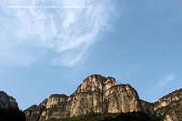
When most climbers think about mountains in China, they instantly conjure up images of the High Himalaya, Tibet, Xinjiang, and even the remote Chang Tang Plateau. Mountains like Everest, Makalu, and Muztagh Ata and crags like Yangshuo are such well-worn destinations for climbers and hardened mountaineers. That being said, not nearly as much thought is given to the east of China. Of course, the mountains are smaller, but they do house some hidden gems that many a climber would be thrilled to find.
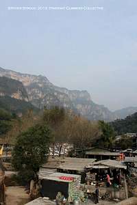
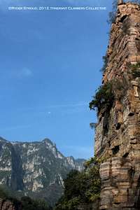
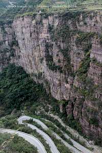
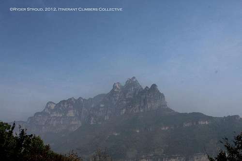
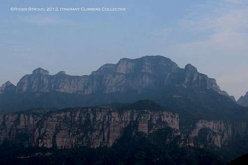
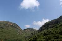
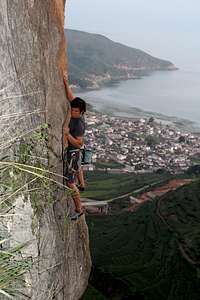
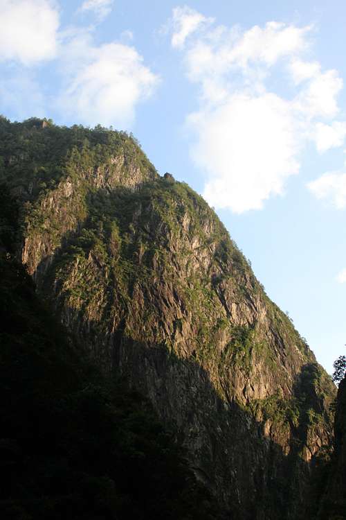
The Wanxian Mountain region of the Taihang Mountains is just that kind of hidden gem. The entire Taihang Range is about 400 kilometers running north to south and has an average elevation of 1500 to 2000 meters, the highest point being Xiao Wutaishan (2882 meters) in Shanxi Province. The Wanxian Mountain region is found in central Henan Province, a stone’s throw away from the provincial capital of Zhengzhou. Given the fact that train and bus access to the region is fairly easy from places like Shanghai or Beijing, access is not a problem, though if you go during China’s National Day holiday (the Chinese version of Independence Day), prepare to be gawked at by Chinese sightseers when you climb.
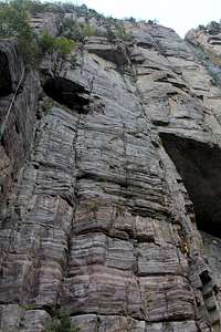
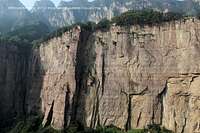
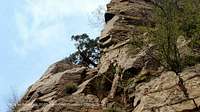
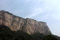
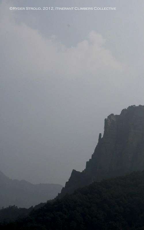
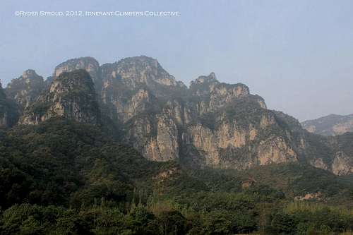
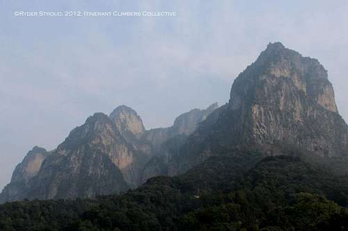
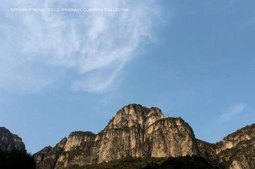
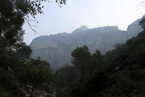
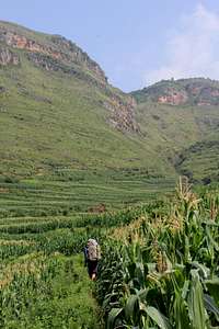
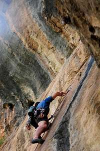
What makes this range unique is not its size, but its geography (and geology). When you arrive in Xinxiang (the jump-off point before taking buses), you might very well be greeted by flatlands and Chinese smog. However, after about 1.5 hours on the road, you will have craggy ridgelines and incredible cliffs rising up around you. The very special feature of this area is the geology. When you enter the park, you will be traveling beneath 100-200 meter sandstone cliffs. Atop the cliff is a broad plateau on which there are some villages and even farmlands. What is even more incredible is that from the back of the plateau rise more mountains. Many of these mountains’ summits are guarded by sheer cliffs requiring technical climbing from every possible angle of approach.
A Little History
According to the placards and signs I read, this area of the Taihang Mountains, especially the cliffside village of Guoliang, is steeped in some interesting political history. The village itself was settled by a small minority (unclear whether ethnic or political) group over a century ago as they fled persecution in the nearby city of Kaifeng. Fleeing into the Taihang Mountains, these people eventually settled a virtually self-contained village atop the cliff, Guoliang. The story has it that the only way to access the village was via a small two-foot wide series of ladder rungs that snaked their way to the top of the cliff. Who knows? Maybe they were the first Chinese to set up and regularly use via ferrata! Apparently, the people of Guoliang lived a fairly isolated life until the threat of persecution lifted in the mid-20th century.
Like many beautiful scenic areas in China, the potential for big tourism dollars became more apparent, especially as China opened up to the international community in 1979. The residents of Guoliang soon became aware of this potential and wanted to establish a more firm connection with the rest of China… at least with people at the bottom of the cliff! However, the local government refused to fund a public works project to build a road to the top of the cliff. Of course, a bunch of locals trying to do such a task would seem like a Herculean feat! However, the local work ethic prevailed when a bunch of locals came together to pool funds for a road. More specifically, they purchased dynamite and lots of it. What resulted was a massive project of blasting into the cliff. What resulted is not your standard roadcut into a mountainside. This tunnel, the Guoliang Tunnel, is quite literally a giant hole into the side of the cliff; it does not have a constructed interior tunnel shell or infrastructure. What you see around you is the actual cliff itself with a pretty simple concrete road.
Today Guoliang and the Wanxian Mountain area is a big destination for Chinese tourists, especially around 国庆节 (China’s Independence Day). That being said, it is one of the few national parks in China in which climbing has also become a officially sanctioned activity within the park borders. So the good news is: there is basically NO RED TAPE when it comes to climb. You can make much like we did: enter the park (park entrance fee involved) and GO CLIMBING.
Getting There
There is a myriad of ways to get to Guoliang and its surrounding areas in the Taihang Mountains. The cheapest choices are by bus and by train. The Chinese rail system is quite comprehensive and hits a lot of the major inland cities. If not, the nearest city is usually connected by another bus line. China’s high-speed rail has also become quite developed along major travel arteries and fortunately, routes like Beijing to Xinxiang (your jumping off point for the mountains) have high-speed rail.
From Beijing take a (high-speed) train to Xinxiang (新乡)(Helpful hint: On train tables/ticket service listings, high speed train numbers are always preceded by “D” or “Z,” slow trains by “K” or T.” Local trains will have NO letter in front of it. Do NOT take a local train unless you want to possibly triple your travel time.
If you take the high-speed train from Beijing, you will reach Xinxiang in about 5 hours. From the station, you can try to find a bus at the station that goes to Huixian (辉县), the next and final proper ‘city’ before heading into the mountains. Alternatively, you can catch a local bus if you leave the station, hit the first intersection and turn left onto “Freedom Road” (自由大街). Across from a big mall, which has a big open plaza at the entrance, there is a local bus stop. Wait there and board a bus headed for Huixian (some buses will actually have the final destination posted on the front window, so pay attention).
Upon reaching Huixian, you will be dumped off at yet another bus station. There will generally be ticket people under a small pavilion. Tell them you want to go to Guoliang (郭亮), and you should be able to get a ticket for 15 RMB. Avoid trying to hire a driver because, unless you are a fierce negotiator, they will way overcharge you for this trip.
This final bus will bring you to the Wanxian Mountain Park entrance gate (it is a national park after all…). To get into the park:
1.) Buy a ticket from the entrance station. It should be 80 RMB to enter and 45 RMB for the bus card, which is valid for 3 individual bus trips, which is quite useful for traveling to the different crags in the area.
a. This might seem a pain for access. While more secretive ways to enter the park may exist, such behavior will not be good for future access to climbing in the park. When you do the math, the entrance fee and bus tickets come out to less than USD 20. In fact, it is almost the same price as a single day pass to access the Gunks!
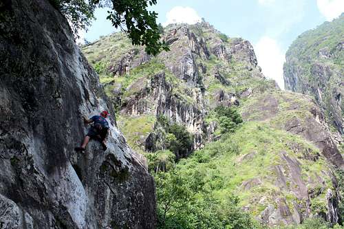
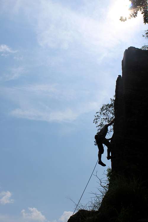
Climbing Areas
Guidebooks divide the area into lettered sections:
A note on names/translations: The named routes have their Chinese names first followed by the Romanization in parentheses. The name in quotes is my translation (or as close as I could get to one...). Any name in brackets is a fun nickname that I and my group attached to them for the sake of easy remembrance of certain features during the trip. Of course, I respect all local names and the nicknames are simply an amusing afterthought.
Areas:
The places my group and I personally scouted and climbed:
A Section: 悬羊擂鼓 (Xuanyangleigu) "The Sheepskin Drum" [a.k.a “Tunnel Wall”]
• This wall is the one that houses the tunnel proper. While B section is actually directly underneath the road, the Tunnel Wall extends out past the point at which the road starts switchbacking down into the valley.
o A1-A4, 悬羊擂鼓 (Xuanyangleigu):
• 5.9, 140 meters, 4 pitches (5.7, 5.8, 5.7, 5.9)
• Trad
• Gear Anchors, FA: 雷嫒, 伍鹏,小河,赵凯
• My group scouted the base of this route. While it does have an incredible location on a prominent arête of the cliffs, the route quality did not look all that great. The approach was also a massive pain. The lower pitches look ledge-y, with all the moderate lines sporting plantlife, though there are much cleaner, harder lines on the walls around the arête. Since this area is so infrequently accessed, significant bushwhacking is involved to get to the base of the arête.
o A5:
• 5.10, 50 meters
• Trad
• FFA: 伍鹏
• Bring 2 ropes for a single, two-rope rappel.
o A6:
• 5.10b, 50 meters
• Trad
• FFA: 伍鹏, 小河
• Bring 2 ropes for a single, two-rope rappel.
o Both of these routes seem to ascend better rock than the nearby multipitch arête climb. That being said, very little information exists on Western climbing sites about routes like these. Judging by the rock in the area, these two routes might also be able to be climbed all the way to the top of the cliff.
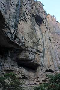
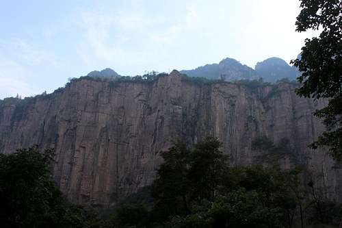
B Section: 郭亮洞 (Guoliangdong), “Guoliang Cave”
• If you want plenty of enjoyable sport routes, you will find them here. The routes in local guidebooks only capture a segment of this area, since climbers from Zhengzhou have bolted overhung routes beneath the road. This is also the section to go to if you enjoy Chinese tourists staring at you and taking your picture with very expensive cameras (fun for all the gumby’s out there!).
o Routes:
• Left of Guoliang Cave
• B2:
o 5.11a, 20 meters
o Sport (8 bolts + anchor)
o FA: 秋香 (Paul Qiu), 小贾, 2003
• B3
o 5.8, 25 meters
o Sport (9 bolts + anchor)
o FA: 秋香 (Paul Qiu), 小贾, 2003
• B4 and B5
o 5.10, 22 meters
o Sport (6 bolts + anchor)
o FA: 秋香 (Paul Qiu), 小贾, 2003
• B6
o 5.10, 20 meters
o Sport (5 bolts + anchor)
o FA: 秋香 (Paul Qiu), 小贾, 2003
• B7, 催粗腿 (Cuicutui):
o 5.9, 20 meters, 1 pitch
o Trad
o Gear anchor, FFA: 福尔马林,2007/5
• B8, 宽缝 (Kuanfeng):
o 5.10d, 25 meters, 1 pitch
o Trad
o Bolted anchor, FFA: Torsten Treufeld, 2009/10
• B9, Y缝Y (Y-Feng-Y):
o 5.10+, 58 meters, 2 pitches
o Trad: 1st pitch: 5.9+, 2nd pitch: 5.10+
o Bolted anchors, FA: 小河,李悦, 伍鹏 (Freewind)
• B10, 欢迎来郭亮 (Welcome to Guoliang):
o 5.9, 10 meters
o Sport (6 bolts + anchor)
o FA: 伍鹏 (Freewind),王茁 (Kristian)
• Beneath and Right of Guoliang Cave
• 学生证 (Xueshengzheng):
o 5.9+, 15 meters
o Trad
o Tree anchor, FFA: 福尔马林,2007/5
o Ends at the road of Guoliang Tunnel. Not a highly recommended climb.
• Amphitheater Routes 1-10:
o 5.10+ to 5.12+ (estimated): These routes were just bolted and established by local climbers from nearby Zhengzhou, so none of them are in current guidebooks. Count on overhung, RRG-type sport climbing. Bolted anchors.
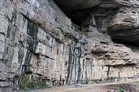
C Section: 通天塔,“Tower of Babel” [a.k.a “Battery Wall”]
• This wall is across the way from the B Section Wall. There are fewer routes, but there are some more easily accessible, worthwhile trad lines on certain portions of the wall. Unfortunately, a few of the routes on the far right of this wall (closest to the village of Guoliang) are dogged by garbage issues, as tourists on the cliffs above throw their trash over the edge. Areas farther left on the wall should be cleaner and much more enjoyable to climb.
o C1
• 5.10a, 28 meters
• Trad
• Bolted anchor, FFA: 小河, 2005
• This dihedral is a stellar stemming corner. Unfortunately, it is close to a field of garbage thrown over the cliff by Chinese tourists.
o C2: 观景台 (Guanjingtai), ”Scenic Vantage Point”
• 5.7, 20 meters, 1 pitch
• Trad
• Tree Anchor, FFA: 伍鹏 (Freewind), 2004
• This route ascends what I call the “Foam Finger Buttress” (looks like a foam finger you see at sport events). This route ascends only a tiny portion of the entire buttress. The whole buttress has multiple potential new lines on either side of the buttress. There might even be potential to extend this line higher onto the buttress. The top of the buttress also features a tourist lookout platform, so you can freak out some Chinese tourists by finishing any new route right on the platform!
o C3: 六人行 (Liurenxing), “Six Line”
• Project, 46 meters, currently 2 pitches (5.10c 26m; unknown, 20m)
• Trad
• Bolted anchors, FA: 小河 (1st pitch), 裂缝 (2nd Pitch), 2007/2010
• Bolted and equipped by: Gump, 2005/8
• Around the corner from “Battery” (C4)
o C4: 电池 (Dianchi), “Battery”
• A1, 54 meters, 3 pitches, (5.9, 22m; 5.9+, 20m; 5.? A1, 12m)
• Trad
• 1st and 2nd pitches: bolted anchors, 3rd pitch: tree anchor, FA: Gump, 2005/8
• This seems like one of the more aesthetic lines on the Battery Wall, though the third pitch is a bit of an unknown in terms of its free grade. Considering the previous pitches were freed as high as .9+, I would could on something in the range of a stout .10/.10+ if it currently goes at A1 (unknown whether C1 or A1). However, the third pitch is only 12 meters long to reach the rappel ledge.
o C5: 陨石坑 (Yunshikeng), “Crater”
• 5.9, 27 meters, 1 pitch
• Trad
• Bolted anchor, FFA: 小河
• Equipped by: 原上草 2005/8
o C6: 向左走,向右走 (Xiangzuozou, Xiangyouzou), “Go Left, Go Right”
• 5.11a, 27 meters
• Sport (8 bolts + anchor)
• FA: Torsten Treufeld, 2008/9
• Equipped by: 原上草, 飞马 (Marshell), 2005/8
o C7: 911
• [Unknown], Project, 27 meters
• Sport (10 bolts + anchor)
• Equipped by: 原上草, 2008/9
o C8: Fade to Black
• 5.9+, 24 meters, 1 pitch
• Trad
• Bolted Anchor, Equipped by/FFA: Gump, 2005/8
o C9:通天塔 (Tongtianta) “Tower of Babel”
• 5.9+, 2 pitches
• Trad
• Gear anchor, Bolted anchor at top, Equipped by/FFA: 原上草, Gump, 2005/8
• This route will require a full 60-meter rappel. The last 12 meters can be anchored using a tree on-route.
o C10: 幻听 (Huanting) “Auditory Hallucinations”
• 5.9, 31 meters, 1 pitch
• Trad
• Bolted anchor, Equipped by/FFA: 原上草, 2005/8
o C11: 新约 (Xinyue) “New Testament”
• 5.10 A1, 135 meters (Pitch 1, “Matthew:” 22m, 5.9; Pitch 2, “Mark:” 35m, 5.6; Pitch 3, “Luke:” 33m, 5.10; Pitch 4, “John:” 45m, A1)
• Trad
• Gear anchors, FFA: Gump, J.T. Baller, 2008/9
• This is the only route on the Battery Wall that goes ground-up all the way to the top of the cliff. Not much beta is known at this time, but with a 5.10 free pitch and an A1 aid pitch, the route could probably go free somewhere in the 5.11-5.12 range.
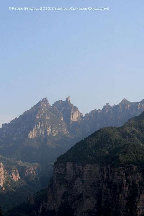
友谊峰 (Youyifeng), “Friendship Mountain” [“Rollkai Spire”]
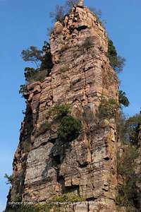
• Youyifeng is a pinnacle that stands near the roadcut that connects Nanping village in the valley up to Guoliang village atop the cliff. The pinnacle stands apart from the cliff and offers potential for some interesting routes on the sides that face away from the roadcut proper; the section facing the roadcut has more loose rock). There is currently only one established trad line on the pinnacle, but it is worth it for the views you will get at the top!
o

“Weibo (微薄) Paparazzi”
• 5.9+, 3 pitches (5.8 15m; 5.9+, 15m; 5.7, 30m)
• Trad
• Gear anchors, tree anchor for rappel, FA: Ryder Stroud, Tavis Barr, and Dylan Barnard
• Approach: If you’re staying in Nanping village, hike the road uphill from town towards the cliffs. This is also the same approach to get to D section crag. Follow the switchbacks up the road until you are beneath the pinnacle. It is impossible to miss, since it is the only pinnacle that sits immediately next to the road. Hop the little retaining wall and scramble across the talus to the base of the spire.
• Pitch 1: Start up the small Y-shaped crack to the right of the lowest point of the scree field (which ends in another huge retaining wall). When you hit the first ledge, do a short hand traverse until you are in a blocky corner. Follow the short corner up to a broad, flat belay ledge beneath a thin crack. (5.8, 15m)
o Pitch 1 variation: Ascend the corner and crack up to the short corner described above. The crack will finish with fist+ size (awkwardly between big crack and squeeze chimney size), so protection and climbing may get hard fast. This variation would allow for pitches 1 and 2 to be linked). (5.9+, R, 15 or 30m)

• Pitch 2: Crux pitch. From the platform, Follow the crack that runs straight up from the ledge. There is a jug to start, and your feet will be just out of view. The crux moves are early on, though the pitch is sustained. Jam your way up the crack until some face holds appear as you approach a short corner. Reach the next ledge and build your anchor in the obvious alcove. (5.9+, 15m)
• Pitch 3: Climb straight up from the belay alcove following another obvious crack. Mellow, blocky climbing will lead you to the crack’s end, at which point trend up and left across an exposed face (nice exposure!) to a small ledge featuring a short, right facing corner with a finger crack (short crux). Climb up it until you can continue trending up and left across various arêtes and gullies. Toward the top of the spire, you will be faced with 2 prominent gullies to the top. The right is a more direct line with the pitch, but a bit dirty. The left will allow you to avoid groveling more by climbing on the arête more. Reach the top and enjoy the 360º panorama. There is some rock at the top to build an anchor, though you might want to belay off your harness/body to avoid directly loading the eroded rock. (5.7, 30m).
• Descent: From the top, locate a big, sturdy, 2-trunk pine tree 15 ft. down a scrambly, dirty gully on the roadcut side of the pillar. Rap from there (we left a rap anchor on the bigger trunk as of Fall 2012). One 60m rope will push it, so you might want a double rope rappel for this one. However, because of the position of the tree, you might have to do a short rap to get to the tree (we did a short lower off a boulder atop the spire (you’ll find a purple cordelette and 2 lockers as of Fall 2012). You could rap directly from the top, but that would certainly require a double rope rappel and a nice backup on the boulder anchor (sparse because the trees directly atop the pillar are more akin to bushes…). Also: be careful when you rap. Any loose rock encountered will get spit out onto the road, so be aware of buses and pedestrians passing nearby!
Other climbing areas scouted, but did not climb:
D Section: 厚碑 (Houbei) “Thick Stone” [a.k.a. “Switchback Wall”]
• The Thick Stone Wall is located just up the road from the valley village of Nanping, the quasi-“sister village” to the Cliffside village of Guoliang. It is located at the base of a bunch of switchbacks you will most likely have taken to get down from Guoliang to Nanping. It is also located just opposite of Youyifeng/Rollkai Spire. This area has a concentration of single pitch trad lines, if you are looking for some relief to all the sport lines that pervade many Chinese crags. Despite the nearby road, the wall is nicely situated near a stream, waterfall, and amphitheater. The amphitheater has another pillar that has potential for great trad lines!
o D1: “Rocknut”
• 5.7 27 meters, 1 pitch
• Trad
• Tree anchor, FFA: 伍鹏, 2007/2010
o D2: 平安中秋 (Ping’anzhongqiu) “Safe Mid-Autumn Festival”
• 5.12b, 20 meters
• Sport (6 bolts + anchor)
• FFA: 爬虫, 2009/10, Equipped by: 王二, 2009/10
o D3: [No name]
• 5.9, 23 meters, 1 pitch
• Trad
• Tree anchor, FFA : 伍鹏 (Freewind), 2007/2010
o D4: [No name]
• 5.9, 21 meters, 1 pitch
• Trad
• 2 bolts anchor, FFA: 天兰, Equipped by: 裂缝, 2005/7
o D5: 刺毡 (Cizhan) “Splinter in the Felt”
• 5.9+, 22 meters, 1 pitch
• Trad
• 2 bolts anchor, FFA: 小河, 2005/7
o D7:梨香院 (Lixiangyuan) “The Field of Sweet Pears”
• 5.9, 27 meters, 1 pitch
• Trad
• Tree anchor, FFA: 裂缝, 2007/10
o D8: 墨线 (Moxian) “Ink Line”
• 5.9+ A0, 120 meters, 3 pitches (Pitch 1: 5.9+ A0, 45m; Pitch 2: A0, 25m; Pitch 3: 5.8+ A0, 50m)
• Trad
• 1st pitch: tree anchor, 2nd pitch: 1 bolt, 3rd pitch: gear anchor; FA: 小河, 裂缝, 2006/7
• The rating for this climb is bizarre and completely paradoxical. The first ascentionists seem to have pulled on gear for the first pitch but were not able to free the easier 3rd pitch, which seems within their abilities given the ratings assigned to other climbs for which the FA bears their names, respectively. The 2nd pitch is also a mystery as simply A0. Regardless, this route can probably go free without much of an increase in grade (probably somewhere in the low- to mid-5.10 range.
E Section: 石缝旮旯 (Shifenggala) “Crevice Corner”
• Shifenggala is one of the more remote crags in the Wanxian Mountain Park. It is situated to the south of Nanping Village. However, given the three of the most remote established crags in the area, Danfengou, Zhuangao are more remote than Shifenggala. I did not find out to much about this crag from some of the local climbers I met in the area. However, the topos from one of the Chinese guidebooks indicates that it should be close to an established trail. That being said, be wary of the fact that the trail might not be conspicuous. Trails do not receive regular maintenance unless they are part of the heavily used scenic area paths. Also, these paths might be overgrown depending on how heavily the area receives foot traffic.
o E1: 从地狱到天党 (Cong Diyu Dao Tiandang) “From Heaven to Hell”
• 5.10c, 28 meters, 1 pitch
• Sport/Trad (4 bolts + anchor)
• FA: 小河, 2006/7
• Equipped by: 小河,伍鹏 (Freewind)
o E2: ATS
• 5.12a, 26 meters
• Sport (10 bolts + Anchor)
• FA: 装缝 2005/7
• Equipped by: 小河, 装缝 2005/7
o E3: 死跑龙套的 (Singpaolongtaode) “Death Plays Only a Small Role”
• 5.10b, 24 meters
• Sport (8 bolts + anchor)
• FA: 原上草,2005/7
• Equipped: 王二,2005/7
o E4: 南昆小路 (Nankunxiaolu) “Nankun Route”
• 5.10a, 33 meters, 2 pitches (5.9, 15m; 5.10a, 18m)
• Trad
• 1st pitch: Gear anchor, 2nd pitch: Tree anchor
• FFA: 2005,7
• Bring 2 60m or 1 70m rope to rap down.
• One of the local guidebooks has a line that roughly translates as: “When you reach the top of the route, cross 10 meters through the bushes to Nankun Paths.” It is unknown if this pertains to anchors or the rappel line. I do not assume it to be a walk-off, since I don’t think it reaches the top of the cliff even though this crag occupies a shorter section of cliff.
F Section: 庄凹 (Zhuangao) “Village Gully”
• Village Gully is just south down the cliff from Crevice Corner. Continuing with the theme from the previous crag, this is one of the more remote crags in the park. Keep in mind that paths to the crags might not always be very conspicuous since climbing traffic is much less frequent than the States, Canada, or Europe.
o F1: 草木皆兵 (Caomujiebing) “Everyone Is an Enemy”
• 5.9, 26 meters, 1 pitch
• Trad
• Tree Anchor, FFA: 原上草, 2005/7
o F2: [No Name]
• 5.8, 16 meters
• Sport (6 bolts + anchor)
• FA: Unknown
o F3: 007砰 (007 Peng) “007 Peng”
• 5.11b, 15 meters
• Sport (5 bolts + anchor)
• FA: 王二,2008/9
• Equipped by: 王二,原上草,三儿, 2008/9
o F4: [No Name]
• 5.9, 15 meters
• Sport (6 bolts + anchor)
• FA: Unknown
o F5: 其实,我是一个演员 (Qishi, Wo Shi Yi Ge Yanyuan) “In Fact, I was an Actor”
• 5.10c, 18 meters
• Sport (7 bolts + anchor)
• FA: 王二,2005/7
• Equipped by: 王二,伍鹏 (Freewind) 2005/7
o F6: [No Name]
• 5.10a, 13 meters
• Sport (5 bolts + anchor)
• FA: Unknown
o F7: 斗地主 (Doudizhu) “Fight the Landlord” (Chinese card game)
• 5.12c, 14 meters
• Sport (5 bolts + anchor)
• FA: 王二, 2006/8
• Equipped by: 原上草, 飞马 (Marshell) 2006/8
G Section: 丹分沟 (Danfengou) “ Red Ravine”
• The most remote of the southern crags. Red Ravine is just south and on the opposite cliff from Village Gully. The local guidebook has only one route, one of the few clearly defined, multi-pitch trad lines that go ground-up all the way to the top of the cliff. Given the proliferation of sport climbs in the area, this trad line might be worth the trip!
o G1: 门神 (Menshen) “Door Good”
• 5.10 c, 80 meters (5.9+, 30m; 5.10c, 30m; 5.10a, 20m)
• Trad
• Gear Anchors, FFA: 小河,装缝 2005/7
• One of the few clearly defined, bottom-up, multipitch trad routes that run from the bottom to the top of the cliff. This route might make the more remote Red Ravine worth the trip.
H Section: 将军峰(Jiangjun Feng) “The General’s Peak”
• The General’s Peak is a section of cliff featuring a prominent buttress that looms over the village of Nanping. It sticks pretty far out from the cliff, so it is hard to miss if you are looking north from the center of the village. As a reference point, it is located east from Friendship Mountain/Rollkai Spire. This crag also features another prominent multipitch climb, though it seems to top out just short of the top of the cliff.
o H1: 将军缝 (Jiangjun Feng) “The General’s Peak”
• A1, 75 meters, 4 pitches (?, 24m; ?, 24m; ?, 13m; A1, 14m)
• Trad/Aid
• Gear anchors, FA: 王二,装缝,2006/8
• I couldn’t find much more information on this route. The guidebook has no ratings for the first 3 pitches, while the fourth only has an A1 rating. Looks like someone might have to climb it to find out.
o H2: 传声筒 (Chuangshengtong) “Megaphone”
• 5.9, 40 meters, 1 pitch
• Trad
• Tree anchor, FFA: 原上草,2008/9
o H3: 喜蛛 (Xizhu) “Happy Spider”
• 5.10, 13 meters
• Sport (5 bolts + anchor)
• FA: 装缝,2006/8
• Equipped by: 王二,装缝,2006/8
o H4: 8.0
• Project, 17 meters
• Sport (5 bolts + anchor)
• Equipped by: 2006/8
o H5:双人床 (Shuangrenchuang) “Double Bed”
• 5.10c, 15 meters
• Sport (5 bolts + anchor)
• FA: 王二,装缝,2006/8
• Equipped by: 装缝,2006/8
o H6: [N/A]
o H7: [No Name]
• Project, 18 meters
• Sport (7 bolts + anchor)
• Equipped by: 王二,装缝, 2008/9
Where to Camp/Stay
Since it is the “Wild East” (and by that I mean China in general), camping regulation isn’t something that is heavily enforced. I have heard of laws on the books that prohibit camping in certain regions. That being said, it seems that as long as you are not encroaching on someone’s property, no one will realy bother you.
In the case of Guoliang and the Wanxian Mountain Park, camping gear can be a burden. There is an endless number of hostels and hotels all over the area, especially in Guoliang and Nanping. Even though everyone you meet in the area is friendly and accommodating, some climbers might not feel comfortable leaving a bunch of their gear in an area where there is no tradition of doing such a thing. Therefore, you might want to save yourself the weight and bulk by just bringing your climbing gear and spending the nights in the villages. Reservation are not really a thing, so you can just roll up to a hotel—they are often restaurants, too—and ask if they can rent you a room.
Red Tape
Aside from the park entrance fee, there is not much in terms of red tape. It's a combined 120 RMB (~18 USD) for the park ticket and 3 bus rides.
My mantra for climbing in China is always:
Respect the locals, patronize local businesses, and help clean up the area.
Since this park is also a big tourist attraction, trash in some places can be a problem. Thankfully, most of the crags are remote enough that trash is not a chronic issue. However, trash is a problem closer to the population centers within the park. Keep this in mind. Just be aware of it, and don’t let it ruin your climbing experience. Climbing in and around Guoliang deserves more recognition because the area definitely makes it a must-climb destination in China’s eastern region!
Resources and External Links
- China Rock Climbs Guidebook (中国野外攀岩指南), Editor: Tingyo (篇着:小瑜), Translator: Hejin (翻译:何瑾)
- Climb Dali: http://www.climbdali.com/html/ClimbinginChina/
Although Climb Dali is based out of western Yunnan Province, the proprietor, Adam Kritzer has this page that has a good overview of many of the emerging climbing areas in China.
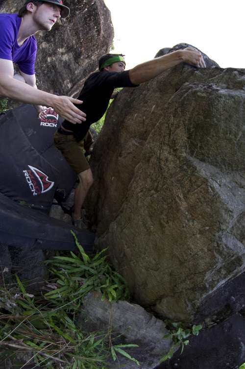
More Photos
I added some more photos to the end of the page to give people a better idea of what Guoliang is all about. Enjoy!

Shuanglang (爽朗)Crag (a.k.a "Hardcore Crag")
Location: West Erhai Lake, Yunnan Province, China
Approximate Elevation: 6857 ft./2090m
Activities: Sport climbing
Overview

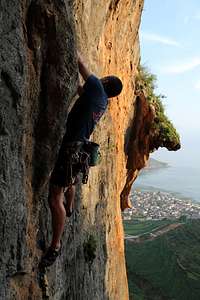
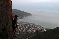
“Hardcore” crag along with its sister crag “Softcore” are two limestone cliffbands under development on the
north end of Erhai Lake (洱海湖) in Yunnan province, China. It is one of the many projects that Squamish/Canmore expat Dane Schellenberg is currently developing along with other locations such as Shimenguan (also on SP: http://www.summitpost.org/shimenguan-gorge/810670), Temple Crag, and Xiaxi.
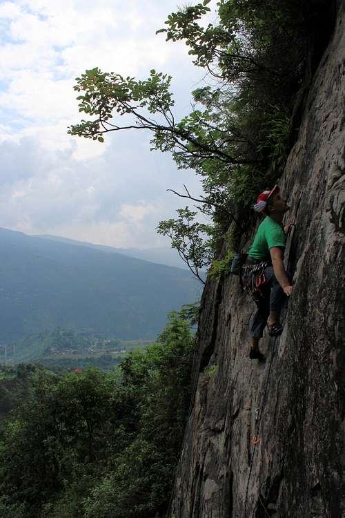
The names of both crags, while amusing in their suggestive themes, are named after the nature of the routes at each crag. Softcore crag features predominantly moderate sport lines, and the cliffband itself has largely been climbed out and established. Hardcore crag, on the other hand, has just been opened up, and all of the lines currently established there are—you guessed it—hard! The easiest sport line at the crag is a stout 5.9+, with the predominant number of current routes being in the 5.10 to 5.11 range. There are even a few 5.12s with a current unsent project that is thought to be a burly 5.12d.
Much like Shimenguan, the draw for this crag is its route potential. Dane has been hard at work outfitting this crag and others. Even with his work, only about 1/3 of the cliffband has been outfitted with bolts. He does plan on continuing work, but the potential for new lines here is incredible, especially in the realm of hard sport climbs from 5.13 and up (though there is plenty of potential to develop routes for normal climbers, too!).
The cliffs themselves are limestone and approximately 30 meters high. The rock features make fore some excellent situational climbing, as the cliffs feature tufas, stalactites, huge overhangs, cracks, and even the occasional rock tunnel.
What makes climbing even more enjoyable at this crag is its location: Hardcore is one of the multiple cliffbands in the area that sit right on the north end of Erhai Lake. On a clear day, you have commanding views of at least half the lake as well as the 4000+ meter ridgeline of the Cangshan (仓山)Mountains on the west side of the lake. Weather in this area can also allow for year ‘round climbing, even during the rainy/monsoon season; some of the overhangs at the crag are more than adequate to shelter you from weather that might surprise you from over the ridgeline.
To editorialize: Dane and I hope that by getting more information out there in the climbing community, we can get more climbers excited about developing routes in China. Unlike Himalayan mountaineering, rock climbing as a sport is a very new phenomenon in China. Much is happening as more expats begin traveling to new crags to develop. A lot is also happening with their interactions and pedagogy with aspiring local Chinese climbers, too. Dane has been doing a killer job at development, but more manpower would certainly speed up development!
For those of you who have grown accustomed to climbing in route-saturated, developed crags, areas like this are a chance to really explore and possibly put up an FA that will bear your name!
Getting There
Most likely, climbers looking to access Hardcore will be doing so from overseas (or from distant locales within China, at least).
The most direct way to get to Hardcore is to fly into the lakeside city of Dali in Yunnan, China. However, the airport is fairly small and will likely be more expensive than flying into a larger city. Many people traveling to Dali will opt to fly into Yunnan’s provincial capital, Kunming, and catch a bus from Kunming West Bus Station (昆明西部车站)to Dali. Buses are quite frequent, leaving about every 20 minutes from the station from 7 am to 11 pm. There is also an overnight bus that leaves from downtown; the latter of the two choices will most likely feature a sleeper bus.
Buses will take you to Xiaguan (下关)which is the more touristy, developed region along Erhai Lake. You can opt to go to Shimenguan from there or base your operations out of Dali Old Town (大理古城)about 15 minutes north. The Old Town while having its touristy elements, feels less like the bizarre overdevelopment that is pervasive in larger Chinese cities.

Whichever location you choose, you will have to hire a van to get you to the north end of Erhai. Usually, you can call a bus/van company and arrange for a driver to pick you up wherever you are staying. It will help to have a friend proficient in Chinese in order to negotiate.
The driver should take you north to the town of Shuanglang. Some of the roads will get bumpy as you pass through some of the rapid development areas along the side of the lake. You will know that you have arrived when you enter a small, quaint Chinese village that is ringed to the north by a long-distance train track and, behind that, a massive bridge that is currently under construction as part of a super highway system being built around Erhai. Once you arrive, head into the village, heading north. You will pass through a small open-air market and a few convenient stores that sell some basic provisions that you can bring up to the crag (things likr instant noodles, water, etc.)
Once behind the town, you should be able to see the cliffs. Pass underneath the massive pylons of the super highway and head for the cornfields that blanket the mountain uphill towards the cliffs themselves. Remember, Hardcore is the cliffband on the right if you are looking uphill.
From there, you need to locate one of the many farmers’ paths that run through the fields. Though there are paths that people like Dane know by heart, nothing there is marked, so more likely than not, you will have to intuit your way towards the cliff by following the paths. Follow the farmers’ paths uphill (be careful! The path drops off steeply downhill once you get closer to the crag!).
Once you arrive at the cliffband, there is a broad ledge that varies from the size of small sidewalk to the width of a small road (better for camping). Some of the best camping is farther left down the cliff (if you are facing the cliff) underneath some huge, rounded overhangs.
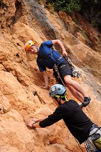
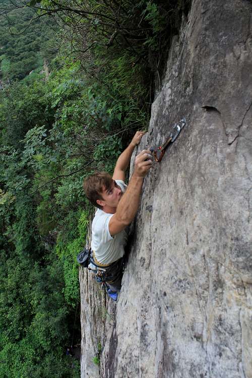
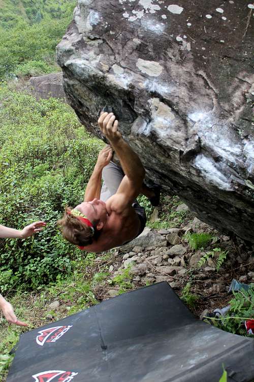
Current Routes and Area Climbs
As mentioned above, there will be a local climbing guidebook available online/in PDF through Adam Kritzer (proprietor of Climb Dali) in the near future. Bear in mind that because this area is under development, versions of the guidebook will change relatively quickly as new routes are bolted and established.
For the moment, I have included some project photos to give interested climbers a glimpse of what climbing at the crag looks like.
Red Tape
Unlike places such as Shimenguan, Hardcore is on non-government land and is not a park. It is likely that some local villagers own the cliffbands themselves, as there is evidence of goat herders and their flocks at the crag itself. However, the cliff does not hold the same significance as the fertile farmland below.
That being said, please be careful when doing things like approaching the crag and camping. Most of the approach to the cliff passes through locals’ farmlands. As long as climbers leave farmers’ livelihoods intact, access should not be an issue.
It will certainly help to patronize local business such as the convenience stores mentioned above. If the locals see climbers as an addition to their livelihoods, they will be far more receptive to an increase in climbing traffic to the area.
Camping

Because the current climbing population going to Hardcore is so small, camping is mostly done at the crag. There are a few broad, flat sections of the ledge underneath the cliffband. Some of these spots are also protected from rain by large, rounded overhangs.
However, it will be wise to save yourself the weight and just stay at one of the many guest houses in the town of Shuanglang. They're pretty basic, but it can beat hauling your camping gear up to the crag.
On the other hand, if you get an early enough start, you can make the whole excursion a day trip, especially if you are basing your operations out of a place such as Dali Old Town, which is much closer to Hardcore than places like Xiaguan.
Local Resources
For more information on the gorge proper, especially what lines have already been established, Dane Schellenberg and Adam Kritzer are your main contact (daneschellenberg@gmail.com).
For more information on other local climbing crags around Dali, you can contact Climb Dali, a local outdoor outfitter run by an American expat, Adam Kritzer (www.climbdali.com).
External Links
Climb Dali, the local outfitter and guide service operating out of Dali Old Town and run by Philadelphia expat, Adam Krtizer: www.climbdali.com
_________________________________________________________________________________
Shimenguan (石门官) Gorge
Location: West of Dali, Yunnan Province, China
Approximate Elevation: 6890 ft./2100m
Activities: Trad climbing, sport climbing, bouldering, top roping, hiking
Potential: Long multipitch trad, big wall
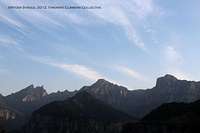
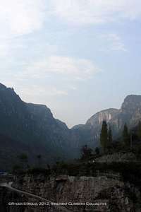
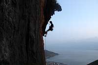
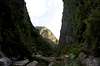
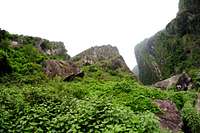
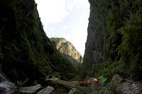
Shimenguan (石门官)is a massive river gorge outside of the southern Chinese city of Dali (大理) in Yunnan province. Though climbing is only beginning to be developed in the gorge, the route potential in the area is one that, I (and the site's main developer, Dane Schellenberg) believe, warrants a page; the gorge and the area surrounding it already have some sport routes and boulder problems, and there is a huge potential for big, multipitch trad routes. The gorge walls themselves are ~300 meters high of Gneiss rock; for those of you with a New England climbing sensibility, the walls are at least as high as the highest point of Cannon Cliff. During the rainy/monsoon season, there will be vegetation on the walls, but even then some lines are still climbable. In the dry season, however, opportunities for big multipitch routes will abound. The walls themselves wind through a gorge for multiple kilometers, so during the right season, there will be a huge supply of potential routes in the gorge proper.
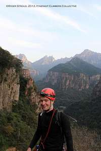
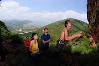
Current development is spearheaded by Canadian expat and Squamish / Canmore climber Dane Schellenberg. Routes have been developed by Andrew Hedesh, Cody Millar, and Adam Kritzer. Bouldering in the area has been developed by those mentioned above along with myself (Ryder Stroud), Matt Krakowski, Carol Wong, Lily Zhang, Jisu Youn, and Andrew Ensign.
Shimenguan has not received much climber traffic, and even now the number of climbers who actively enter the area for development are essentially limited to those names mentioned above plus possibly a handful more climbers. What little information that has surfaced on the Internet does not seem to capture the full potential that Shimenguan has to offer; the primary draw of the area at this point is not its multitude of pre-existing routes, but the potential for such a tight cluster of different types of climbing: sport, trad, multipitch, and bouldering all coexist within the same area of the river gorge.
What this page is meant to do is to encourage those climbers who are used to climbing in classic, route-saturated areas to get out to new places like Shimenguan. There might even be a first ascent in there for you!
A Word on Development
Besides the sport routes and boulder routes that have been established, there is essentially an infinite supply of new routes and problems. Each trip back to the gorge, we discover more boulders and new lines that, with cleaning, could be stellar routes.
If you do plan to develop: You will definitely need to come prepared with equipment for cleaning a route (e.g. heavy wire brushes, nylon stepladders/etriers(you don't want to be hanging by a crimper while cleaning out part of a crack!), small trowel, and possibly plastic covers such as halves of water bottles to protect the gear you are hanging off of from the dirt you will likely knock down on it!)
REMEMBER: Bear in mind that climbing is new in China. Access tends to be a little sketchy, especially since (as it appears to me) Chinese culture is very risk averse (see the “Red Tape” section). Be tactful and respectful if you arrive to develop climbing routes. Patronize local businesses and build good relations with the locals. If they see climbers as a potential addition to their livelihoods, the locals will support more climbers coming into the area. Same thing goes for local ‘park officials,’ though the process with them is a bit more opaque (again, see the “Red Tape section).
Pending Guidebook
A FIRST CUT OF THE SHIMENGUAN BOULDERING GUIDEBOOK WILL BE AVAILABLE SOON THROUGH DANE SCHELLENBERG AND MYSELF. I WILL POST A LINK AS SOON AS IT BECOMES AVAILABLE.
Getting There
It is pretty much guaranteed that anyone headed to Shimenguan for the purposes of climbing will be coming from across continents or oceans. The most direct way to get into Shimenguan is to fly to the lakeside city of Dali, a trip that will usually entail a stop somewhere within China beforehand. Alternatively, you can fly into Yunnan’s provincial capital, Kunming, and catch a bus from Kunming West Bus Station (昆明西部车站)to Dali. Buses are quite frequent, leaving about every 20 minutes from the station from 7 am to 11 pm. There is also an overnight bus that leaves from downtown; the latter of the two choices will most likely feature a sleeper bus.

Buses will take you to Xiaguan (下关)which is the more touristy, developed region along Erhai Lake (洱海湖). You can opt to go to Shimenguan from there or base your operations out of Dali Old Town (大理古城)about 15 minutes north. The Old Town while having its touristy elements, feels less like the bizarre overdevelopment that is pervasive in larger Chinese cities.
Whichever location you choose, the final step to Shimenguan is a matter of calling a van driver and having him bring you to the entrance of the park; this part of the trip might be a little easier if you have a friend who is proficient at speaking Chinese. The van ride will be about 30-40 minutes long, depending on if your driver opts to take the local roads or the highway (the highway is far more preferable); some drivers will not want to take the highway because of the toll costs, but a little haggling over price and conditions will generally get the driver to take the highway,
There is only one road that leads up to the gorge itself, so after you check in with the ‘park rangers’ the driver should drop you off at the trailhead, which is located just after two small white farmhouses/buildings that also double as hotel rooms for tourists.
Head into the park and pick a line; there is a high chance that the stuff you are looking at has not yet been climbed!
Routes and Areas
Dane Schellenberg is currently compiling all of the ascent information to date and will be passing it on to me for design and formatting. The first cut of the book, as stated above, will be available soon.
Bear in mind that the guidebook will change quite frequently as more routes are added.
Current Sport Routes
Apprentice of Satan, 5.10a
BB Kuen Kuen Chu, 5.8
Blood Puke, 5.12c
Cherry Poppin', 5.10b
Donkey Schnitzel, 5.6
Dry Humping 5.10b
Flamingo Kid, 5.9
Kritz-arête, 5.11
Moxis on the Roof David, 5.11c
"Open Project," 5.12d
Red Beard's Choice, 5.10d
Roast Goat Parade, 5.7
So Long and Thanks for All the Bolts, 5.12a
Stolen Baba, 5.10c
The Gardeners of Eden, 5.11a
The Land of Laaa, 5.9
The Mysteries of Vulcan, 5.11b
WWSD, 5.10d
Where's the Peanut Butter, 5.10b
Established route and boulder problem topos coming soon
Some Project Photos
Red Tape
Shimenguan is technically a Chinese national park. Depending on what season you arrive in the area, the gorge will have varying amounts of tourists, the smallest number arriving during the monsoon season of July and August. Regardless, you will have to pay an entrance fee to access the park (generally around 10 RMB per person, depending on the ‘ranger’).
A word on the ‘rangers’ of Shimenguan Park: if you have an idea of what a park ranger is, especially those of you in the United States and Canada, get it out in the case of Shimenguan. The people who manage Shimenguan are indeed government employees, but they are not trained in the way that many Westerners might think. They are more likely than not just local folk who were granted these fairly cushy park jobs by the local government, and they are more inclined to be of hindrance than of help. The first time you arrive, you will most likely have to sign a hastily written waiver absolving the park of any responsibility should you get hurt. These ‘rangers’ might also demand to see your passport as well. If there has been a recent episode of rockfall in the gorge, they might try and stop you from entering.
However, these red tape issues are not insurmountable. Generally, the waiver will allow you to get into the gorge. If there is the occasional persistent ‘ranger’ who does not allow you to enter, you can access the gorge proper by getting an early start.
The ‘rangers’ seem to have less of a problem with climbing outside the entrance to the gorge proper. As a result, the sport routes that have been bolted so far have been just outside the gorge entrance.
Camping
Shimenguan Gorge is a Chinese national park. The park technically closes at sundown, but staffing is quite minimal. Camping might be possible if you stay far away from the well-traveled paths at the end of the day. However, I would AVOID camping in the gorge because of the access issues it will likely cause. The area around Shimenguan is all local farmland, so you do not want to piss off local farmers by accidentally destroying parts of their livelihoods.
Besides the above reason, there really is no reason to haul camping supplies to Shimenguan when the farmhouses at the entrance to the park offer basic hotel rooms for dirt cheap (see "Local Resources" below).
Local Resources
Lodging is cheap and easy at Shimenguan, especially in the monsoon/rainy season, when fewer tourists visit the area. The two white buildings at the trailhead are actually local farmers’ homes, and they rent out their upstairs rooms as hotel rooms for 15 RMB a night (if you do the math, that’s about USD 2.50 per night!). You can also purchase home cooked meals from the owners; I would recommend staying vegetarian, as meat dishes tend to be quite expensive.
For more information on the gorge proper, especially what lines have already been established, Dane Schellenberg is your main contact (daneschellenberg@gmail.com).
For more information on other local climbing crags around Dali, you can contact Climb Dali, a local outdoor outfitter run by an American expat, Adam Kritzer (www.climbdali.com).
External Links
Climb Dali, based out of Dali Old Town: www.climbdali.com
No comments:
Post a Comment